In a world where even pizza can be delivered by a flying robot, it’s no surprise that drones are taking to the skies for mapping purposes. Gone are the days of trudging through dense forests or scaling mountains with a clipboard in hand. Now, with a quick flick of a joystick, professionals can capture stunning aerial views and precise data faster than you can say “topographical survey.”
Overview of Drones for Mapping
Drones for mapping offer a transformative approach to data collection and analysis. These unmanned aerial vehicles (UAVs) enable users to capture high-resolution images and detailed topographical information efficiently. Advanced sensors, such as LiDAR and multi-spectral cameras, enhance the quality of the data collected, allowing for accurate modeling and analysis.
In recent years, industries including agriculture, construction, and environmental monitoring increasingly adopted drone technology. Farmers benefit from drones, which provide insights into crop health and land management. In construction, drones streamline site surveying, reducing time spent on labor-intensive tasks. Environmentalists leverage drones for habitat mapping and monitoring changes in ecosystems.
Real-time data processing is a key advantage of drones. Operators can analyze data on the spot, facilitating quick decision-making. For example, mapping a complex site traditionally requires days or weeks to complete. Using drones, this timeframe can shrink to a few hours, enhancing project efficiency.
Cost-effectiveness also plays a significant role in the adoption of drones for mapping. Businesses save on labor costs and equipment expenses when utilizing UAVs compared to traditional surveying methods. The reduced need for extensive manpower makes projects less resource-intensive.
Regulations surrounding drone use continue to evolve, impacting how professionals approach mapping tasks. Operators must stay informed about national and local laws to ensure compliance. With proper certifications and understanding of airspace restrictions, professionals can maximize the benefits of drone technology for mapping.
Advantages of Drones in Mapping

Drones offer significant advantages in mapping, especially in cost-effectiveness and time efficiency.
Cost-Effectiveness
Using drones reduces mapping costs considerably. Traditional surveying methods often involve high labor expenses and equipment rentals. In contrast, drones can perform similar tasks at a fraction of these costs. Savings also extend to equipment maintenance and operational overhead. For instance, a drone with advanced sensors can replace multiple field crews, resulting in lower personnel costs. Businesses see improved return on investment as drone services eliminate the need for expensive gear. Furthermore, project budgets benefit when aerial mapping solutions replace outdated techniques. In many cases, companies report a cost reduction of up to 70% by switching to drone technology.
Time Efficiency
Mapping projects complete much faster with drones. Aerial surveys can cover large areas in a short time, significantly speeding up data collection. For example, a task that might take days or weeks using traditional methods can now be done in hours. Additionally, drones provide real-time data processing. Instant access to high-quality maps enables quicker decision-making for stakeholders. The quick turnaround allows for immediate adjustments to project plans and timelines. As a result, industries can ramp up their workflows and complete projects ahead of schedule. Overall, the efficiency gained enhances productivity across various applications in mapping.
Key Technologies Used in Drone Mapping
Drones rely on several key technologies that enhance their mapping capabilities. These technologies ensure precision and efficiency in data collection.
GPS and GNSS Integration
GPS and GNSS integration plays a crucial role in drone mapping. These systems provide accurate positioning data essential for mapping tasks. Data collected from drones equipped with these technologies can achieve centimeter-level accuracy. Adopting this integration improves the reliability of the aerial data, allowing for effective analysis and decision-making. Users can track drone locations in real time, ensuring that every mapped point aligns with its corresponding geographic coordinates. This advancement significantly optimizes workflows in various industries reliant on accurate mapping.
Imaging and Sensor Technologies
Drones utilize advanced imaging and sensor technologies to capture high-quality data. Multi-spectral cameras provide insights into vegetation health, making them invaluable in agriculture. LiDAR systems offer detailed 3D representations of terrain characteristics, improving environmental assessments. Both technologies support aerial surveys that cover expansive areas quickly and accurately. Improved data quality facilitates better planning and management strategies in construction and environmental monitoring. Professionals leverage these innovations to enhance their mapping endeavors and gather insights that were previously challenging to obtain.
Applications of Drones for Mapping
Drones play a crucial role in various mapping applications across multiple industries. Their ability to capture data swiftly and accurately transforms traditional methodologies.
Agriculture and Crop Monitoring
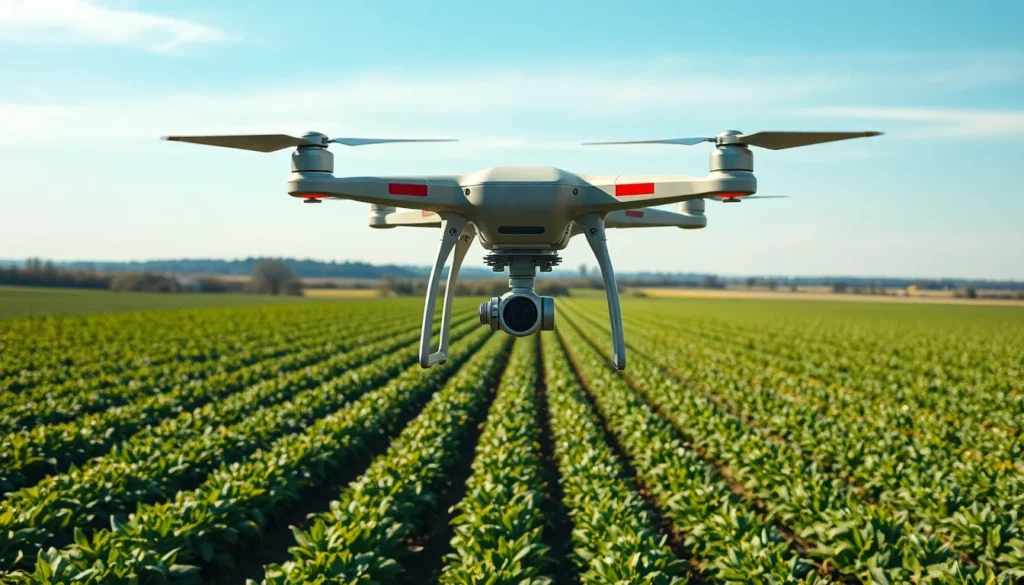
Drones significantly improve agricultural monitoring. They provide aerial imagery that helps farmers assess crop health and identify areas needing attention. High-resolution images, taken in multiple spectral bands, reveal insights into vegetation vigor and irrigation levels. Data collected can lead to informed decisions regarding fertilization and pest control strategies. This targeted approach minimizes waste and maximizes yield potential. Farmers can monitor vast fields efficiently, reducing time spent on manual inspections. Reports indicate that crop monitoring precision improves with drone technology, allowing for higher crop quality and productivity.
Urban Planning and Development
In urban planning, drones offer innovative solutions for site analysis and development assessments. Aerial surveys yield detailed topographical maps, facilitating the visualization of proposed projects. Planners rely on real-time data for measuring land use, zoning, and infrastructure changes. Drones capture 3D models that assist in public presentations, enhancing stakeholder engagement. Moreover, they significantly reduce the time compared to traditional surveying methods, allowing projects to move forward rapidly. Accurate data helps identify potential issues, leading to more efficient land management strategies. Utilizing drones in planning fosters sustainable urban growth while ensuring available resources are used effectively.
Challenges and Limitations
Drones for mapping face several challenges that can impact their effectiveness and usability in various sectors. Understanding these issues is essential for maximizing their potential.
Regulatory Issues
Compliance with regulations presents a significant challenge for drone operators. Each country has unique rules governing drone flight, affecting operational parameters such as altitude and no-fly zones. In the United States, the Federal Aviation Administration (FAA) mandates that commercial drone operations require specific certifications. Failing to adhere to these regulations can result in penalties and jeopardize project timelines. Operators must remain informed about evolving laws to avoid disruptions in mapping activities. Adhering to privacy regulations also poses concerns as data collection can unintentionally infringe on individual rights. Operating within these legal frameworks ensures responsible use of drones in mapping projects while safeguarding privacy.
Technical Challenges
Technical obstacles can hinder the use of drones for mapping tasks. Signal loss, particularly in areas with dense vegetation or urban environments, can compromise GPS accuracy, affecting data integrity. Irregular terrain can also present difficulties in maintaining stable flight, leading to unreliable mapping results. Battery life limits operation time, particularly for large areas, necessitating efficient flight planning. Furthermore, integrating various sensor technologies, such as LiDAR and multi-spectral cameras, demands technical expertise. Operators must be well-versed in handling this equipment to ensure accurate data collection. Addressing these technical challenges is vital for optimizing drone performance and enhancing mapping outcomes across industries.
Future Trends in Drone Mapping Technology
Emerging trends in drone mapping technology are shaping new possibilities for aerial data collection. Artificial intelligence (AI) integration enhances data interpretation, allowing drones to analyze imagery in real-time, identify patterns, and trigger intelligent alerts. These advancements improve decision-making across industries by providing actionable insights efficiently.
Enhanced sensor technology is another pivotal trend. The rise of thermal imaging and hyperspectral sensors enables drones to collect diverse data types, expanding their application scope. Drones equipped with these sensors offer insights into environmental conditions, infrastructure health, and more, greatly benefiting sectors such as search and rescue and disaster management.
Automation plays a vital role in future developments. As automated flight planning continues to evolve, drones can conduct complex flight missions with minimal human intervention. These systems reduce human error during mapping projects, further optimizing efficiency and accuracy.
Increased connectivity is also on the horizon. 5G technology promises to strengthen real-time data transfer and enhance remote operation capabilities. Drones connected to 5G networks can transmit high-resolution images and large datasets instantly, facilitating immediate analysis.
Sustainability is becoming a priority in drone operations. Developing energy-efficient drone models with longer battery life significantly impacts environmental preservation. Eco-friendly drones help reduce carbon footprints while ensuring effective mapping capabilities.
Finally, regulatory advancements aim to accommodate rapid technological growth. Continuous updates to regulations will enhance operational flexibility, allowing for expanded drone usage in urban and rural mapping tasks. Adapting to these evolving frameworks is essential for maximizing the potential of drones in mapping.
Drones have fundamentally changed the mapping landscape by offering unparalleled efficiency and accuracy. Their ability to capture high-quality data quickly makes them indispensable across various industries. As technology continues to evolve, the integration of advanced sensors and AI will further enhance the capabilities of drones in mapping tasks.
While challenges remain, staying informed about regulations and best practices will help operators maximize the benefits of drone technology. The future looks promising as innovations pave the way for even greater applications in urban planning, agriculture, and environmental monitoring. Embracing these advancements will ensure that businesses remain competitive and responsive to the demands of an ever-changing market.